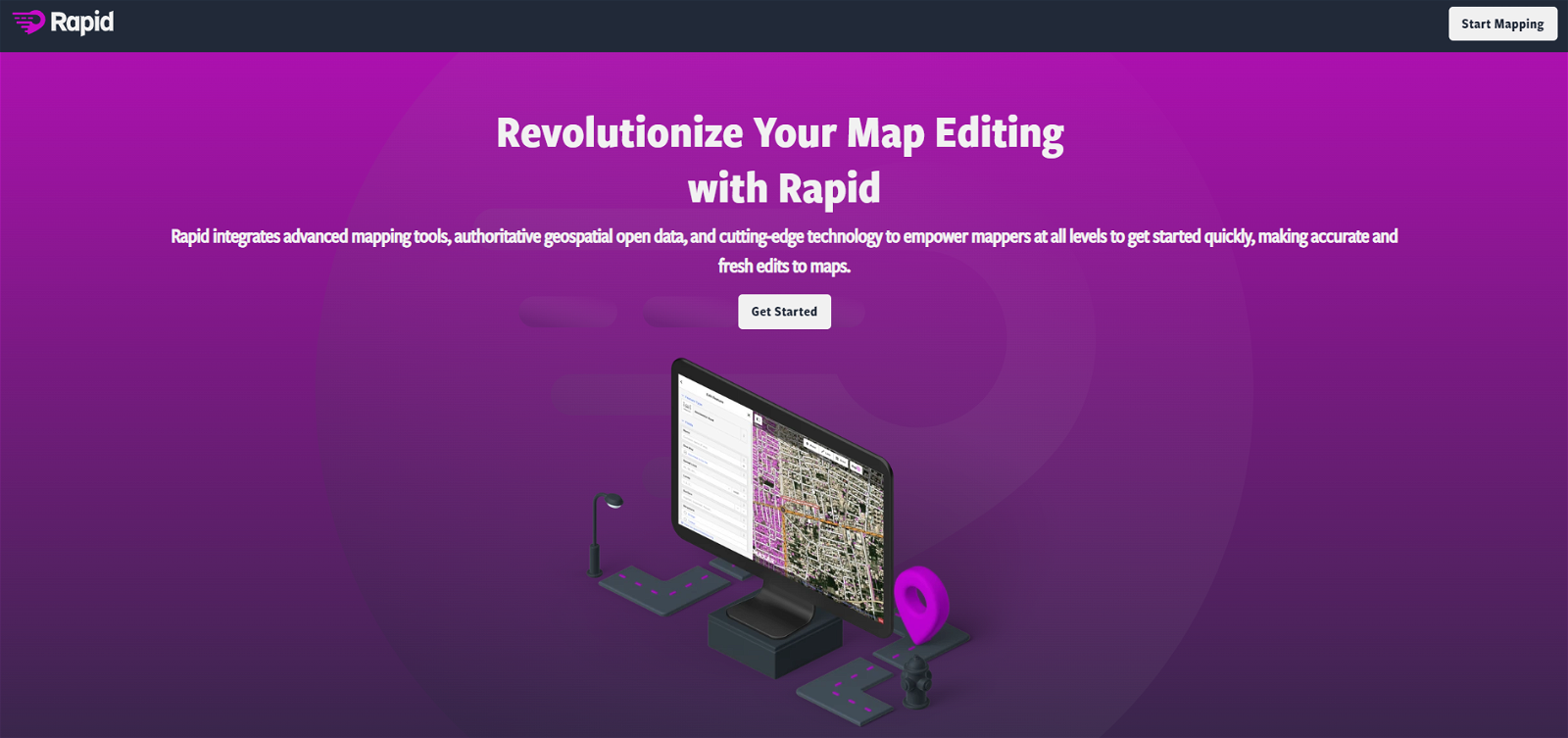
What is Mapwith.ai?
Mapwith.ai is an AI-powered mapping tool that utilizes OpenStreetMap and artificial intelligence to create an efficient and accurate mapping experience. It's designed to predict features from high-resolution satellite images which are then populated in an editing tool called RapiD.
How does Mapwith.ai use AI to enhance mapping?
Mapwith.ai uses AI in mapping by predicting features such as roads from high-resolution satellite imagery. These features are then populated in the RapiD map editing tool, enabling faster and more accurate mapping. Additionally, it employs AI-assisted road hovering and tag-cycling for a more efficient mapping experience.
What is the RapiD map editing tool in Mapwith.ai?
The RapiD map editing tool in Mapwith.ai is a dedicated application for processing AI-predicted features from satellite imagery. It allows the user to map these features quickly and accurately. The tool also has an AI-assisted road hovering and tag-cycling feature for added efficiency.
How does Mapwith.ai identify roads and other features from satellite imagery?
Mapwith.ai uses artificial intelligence to identify roads and other features from satellite imagery. The AI technology predicts these features on high-resolution satellite imagery, converting pixels of satellite map data into predicted features, which are subsequently populated in the RapiD map editing tool.
What is AI-assisted road hovering in Mapwith.ai?
AI-assisted road hovering in Mapwith.ai is a feature that uses artificial intelligence to assist the user in effectively mapping out roads from satellite imagery. The AI is capable of detecting road-like features and bring them to the user's attention, improving the mapping efficiency.
How does Mapwith.ai ensure quality assurance of roads?
Mapwith.ai ensures quality assurance of roads through built-in integrity checks in the RapiD editor. This feature helps detect and correct quality issues on newly added and modified roads, maintaining a high standard of mapping accuracy.
Can I use Mapwith.ai for humanitarian mapping efforts?
Yes, you can use Mapwith.ai for humanitarian mapping efforts. It has been used in various humanitarian efforts around the world, such as the Kerala disaster response in India and training workshops in Thailand and Tanzania.
How does Mapwith.ai use OpenStreetMap?
Mapwith.ai uses OpenStreetMap by integrating it with artificial intelligence. It populates features predicted from high-resolution satellite imagery into the OpenStreetMap via its RapiD editor, creating a faster and accurate mapping experience.
Can Mapwith.ai predict features from high-resolution satellite imagery?
Yes, Mapwith.ai can predict features from high-resolution satellite imagery. It uses artificial intelligence to predict these features, making it a powerful mapping tool.
What is the function of the RapiD editor in Mapwith.ai?
The function of the RapiD editor in Mapwith.ai is to allow users to map out predicted features that the AI has identified. One of its functions is allowing users to turn predicted features into editable ones with a single click. It also helps detect and correct quality issues on the mapped roads.
How does AI assist in map editing in Mapwith.ai?
AI assists in map editing in Mapwith.ai by predicting potential features from high-resolution satellite imagery. It also provides AI-assisted road hovering and tag-cycling, improving the efficiency of mapping. Plus, it helps to identify possible unmapped and missing roads on a global scale.
What is the tag-cycling feature in Mapwith.ai?
The tag-cycling feature in Mapwith.ai allows users to quickly convert AI-predicted features into editable features, including nodes and connections, with a single click. It provides efficiency and flexibility, allowing users to use as many or as few such features as necessary.
How does Mapwith.ai detect and correct quality issues?
Mapwith.ai detects and corrects quality issues on newly added and modified roads through integrated integrity checks within the RapiD editor. This tool helps to maintain a high level of accuracy and consistency in the mapping process.
How do I start mapping with Mapwith.ai?
To start mapping with Mapwith.ai, log in with your OpenStreetMap account. With the RapiD editor, you can explore freely, starting from a chosen area in the map. The RapiD editor allows you to map predicted features identified by the AI.
Can I use Mapwith.ai to map unmapped and missing roads?
Yes, Mapwith.ai can be used to map unmapped and missing roads. The AI technology can present a high-level view of potential unmapped areas and missing roads on a global scale. This is achieved by applying artificial intelligence to satellite data.
How has Mapwith.ai been used in disaster response?
Mapwith.ai has been used in disaster responses, notably during the severe flooding event in Kerala, India in 2018. The local OpenStreetMap community partnered with Mapwith.ai to map missing roads in the affected areas, efficiently aiding in the response.
Does Mapwith.ai offer any training workshops?
Yes, Mapwith.ai offers training workshops. There have been workshops held in locations like Thailand and Tanzania where participants learned to use Mapwith.ai mapping tools for various uses, including OpenStreetMap editing.
Can Mapwith.ai convert pixels of satellite map data into predicted features?
Yes, Mapwith.ai has the capability to convert pixels of satellite map data into predicted features. This is accomplished by leveraging artificial intelligence, which identifies and predicts features like roads from satellite images.
What are the benefits of using AI for mapping in Mapwith.ai?
The primary benefits of using AI for mapping in Mapwith.ai include increased speed and accuracy in mapping. By predicting features from satellite data, the AI saves effort in drawing them. It also helps identify potential unmapped and missing roads, enhancing the completeness of mapping.
Is Mapwith.ai linked to any social cause or community service?
Yes, Mapwith.ai is associated with social causes and community service. It has been used in various global-scale humanitarian efforts to provide rapid and accurate mapping. Notably, it was used in disaster response efforts in Kerala, India and provided training workshops in Thailand and Tanzania.
 15,270